
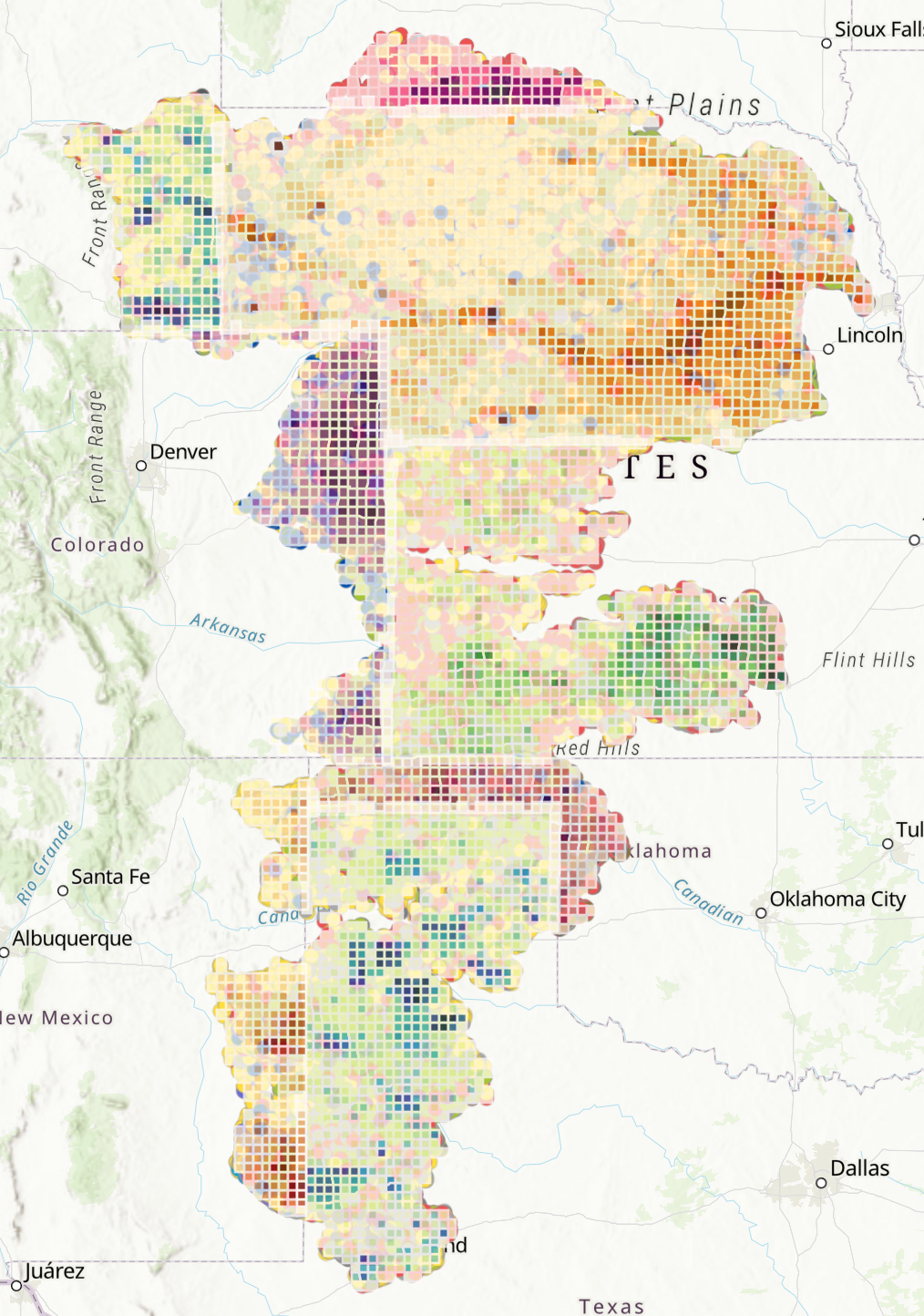
The Ogallala Aquifer is a critically important aquifer in the central United States, underlying approximately 111 million acres, including 1.9 million acres of Tribal land and 2.9 million acres of federal land. The land over the aquifer is the ancestral homeland of a number of tribes, including the Sioux, Arapaho, Cheyenne, Ponca, Pawnee, and Kiowa. Its boundaries include parts of 8 states: North Dakota, Wyoming, Nebraska, Colorado, Kansas, New Mexico, Oklahoma, and Texas; within these states, it provides water for agriculture, municipal uses, industry, and ecosystems.
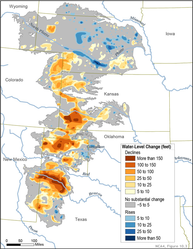
Water was originally deposited in the aquifer between 2 and 6 million years ago, and has long been recharged by shallow playa lakes in the region. The northern reach, which benefits from more porous soils and bedrock, as well as higher precipitation and lower evaporation, has always recharged more quickly than the central and southern reaches. Because water does not easily flow from one reach to the other, this results in rising aquifer levels in some parts of the northern reach, and falling levels in the central and southern. It is estimated that once empty, the aquifer would require ~6000 years, on average, to recharge.
While the aquifer has long provided water in the region via drilling, large-scale water extraction for agriculture and other human uses first began in the 1940’s. Row crops, primarily irrigated, have largely replaced the grasslands that were once the dominant ecosystems over the aquifer. While agriculture is by far the largest water user over much of the region, the aquifer also supplies municipal water to over 2.3 million homes and is used for fossil fuel extraction. In addition, it supplies base flow to a number of streams and rivers in the region. These provide habitat for numerous aquatic species and ecosystems, and support terrestrial systems by providing water sources and shallow groundwater for vegetation.
Demands on the aquifer are only expected to increase with climate change. The climate in the central United States is expected to become warmer, and summers are expected to become both hotter and drier. This will lead to increased water demand for both agriculture and municipal uses, even as increased evaporation results in less water infiltrating into the soil and, ultimately, reaching the aquifer. Furthermore, storms are expected to become less frequent, but more severe, resulting in more runoff and less infiltration.
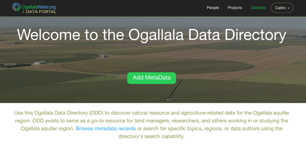
Due to its broad importance to human and natural ecosystems and the economy of the region, an abundance of data have been collected relevant to the Ogallala and the systems it underlies. However, there are challenges to working with these data: 1) Data needed to support long term longevity of ecosystems and economic systems can be difficult to efficiently locate and access, 2) Depth and breadth of available data are unclear due to the disparate nature of datasets, and 3) Disparate datasets also make it difficult to identify gaps in current knowledge. To address some of these challenges, a team from the South Central Climate Adaptation Science Center and Colorado State University developed a comprehensive web site to search, download, and display the disparate datasets associated with water in this region. It makes use of metadata records to provide location information of datasets location across the internet, rather than requiring that all datasets be located within the Directory. This is similar to the function of data.gov, which provides access information for datasets, rather than datasets themselves. The Ogallala Data Directory can be accessed online without an account, but account owners have access to additional features beyond searching, including the ability to upload or edit their own metadata records. Quality control is provided by the developers of the Data Directory to ensure that datasets are not duplicate records or bot-created records and that all necessary metadata have been provided.
It is hoped that the Data Directory, in addition to providing a resource for “one-stop” data searches, will be further expanded by others who are interested in building upon its capabilities. It can be accessed at http://ogallalawater.colostate.edu/OWCAP/Index.php. For further information, please email Dr. Caitlin Rottler at caitlin.m.rottler@gmail.com, referencing the Data Directory somewhere in the subject line.
Credit: NCA4 (https://nca2018.globalchange.gov/)
